Encyclopedia SEIRse'-ir:
(1) (har se'-ir, "Mt. Seir" (Genesis 14:6, etc.), 'erets se`-ir (Genesis 32:3, etc.); to oros See ir, ge See ir): In Genesis 32:3 "the land of Seir" is equated with "the field of Edom." The Mount and the Land of Seir are alternative appellations of the mountainous tract which runs along the eastern side of the Arabah, occupied by the descendants of Esau, who succeeded the ancient Horites (Genesis 14:6; Genesis 36:20), "cave-dwellers," in possession. For a description of the land see EDOM.
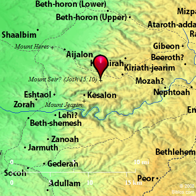
(2) (har se`ir; Codex Vaticanus Assar; Codex Alexandrinus See ir): A landmark on the boundary of Judah (Joshua 15:10), not far from Kiriath-jearim and Chesalon. The name means "shaggy," and probably here denoted a wooded height. It may be that part of the range which runs Northeast from Saris by Karyat el-`Anab and Biddu to the plateau of el-Jib. Traces of an ancient forest are still to be seen here.
W. Ewing |
    |